If you’re a Future Soldier preparing for Basic Combat Training, one of the most important skills you’ll learn is basic land navigation and map reading. These aren’t just old-school skills—they’re essential Soldier tasks that can make the difference between mission success and failure. While the Army uses advanced GPS and technology, you’ll still be trained to navigate with nothing but a map, compass, and your own know-how.
Why Land Navigation Matters
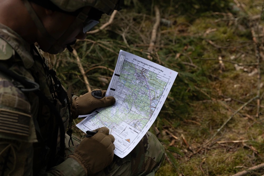
In the Army, knowing where you are, where you need to go, and how to get there—without relying on technology—is a critical survival skill. Whether you’re moving through unfamiliar terrain during training, a field exercise, or a real-world mission, the fundamentals of map reading ensure you can operate confidently and independently.
Key Tools You’ll Use
- Topographic Map – Shows terrain features, elevation, roads, water sources, and more.
- Compass (Lensatic) – Your main tool for determining direction.
- Protractor – Used to measure azimuths (direction in degrees) and plot points.
- Map Coordinates & Grid System – The Universal Transverse Mercator (UTM) grid breaks maps into manageable squares, helping you pinpoint exact locations.
Map Reading Basics
You’ll learn to identify:
- Terrain features – Hills, valleys, ridges, depressions, and saddles.
- Contour lines – Lines that connect points of equal elevation, showing the rise and fall of terrain.
- Symbols & Legend – Every Army map has a legend that explains the meaning of symbols, roads, trails, and boundaries.
Plotting a Point
During training, you’ll practice taking a grid coordinate (like 13S E 12345 67890) and plotting it on your map using a protractor. Once plotted, you’ll use your compass to find the direction and distance to your destination.
Azimuth and Back Azimuth
- Azimuth – Your direction of travel, measured in degrees.
- Back Azimuth – The opposite direction, useful for retracing your steps.
You’ll train to shoot an azimuth with your compass, keep it steady, and follow it through all types of terrain.
Day and Night Land Navigation
In Basic Training, you’ll do both:
- Day Land Nav – Easier visibility, allows you to use terrain features.
- Night Land Nav – Forces you to rely heavily on your compass, pace count, and precision.
Tips for Success at Basic
- Learn your pace count – How many steps it takes you to travel 100 meters.
- Trust your compass – Don’t second-guess it unless you’ve verified your map reading.
- Keep situational awareness – Look around, note landmarks, and track your movement.
- Stay calm under stress – Land nav tests your mental focus as much as your skills.
The Bottom Line
Land navigation isn’t just a test at Basic—it’s a core Soldier skill you’ll carry throughout your Army career. Mastering it shows you can adapt, think critically, and move with confidence in any environment. When you arrive at BCT already familiar with maps and compasses, you’ll be one step ahead—and ready to lead the way.
I’ll be back next week with more tips and guidance. Until then, Hooah!
SGM Kris Broadus, U.S. Army (Retired)